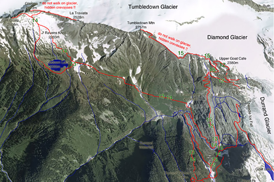
Swiss Meadows – Tumbledown Lake trail
- Level of hiking: Moderate
- Lowest elevation: 1692 m, Twin Falls
- Top elevation: 2100 m, Tumbledown Lake
- Total elevation gain: 746 m
- Total distance: 7 km
Route:
From the Durrand Glacier Chalet follow the main trail past the shower building towards east for 150 meters, cross the tiny stream and continue east for 60 metres more and then follow the main trail branching off towards the left and downhill to a bridge. Cross the bridge and keep following the markers and wide trail to the upper Carnes Creek.
Cross the Carnes Creek Bridge and branch off to the left and walk along the marked trail downhill, along the impressive Carnes Creek. This brings you to the large flat area of the Twin Falls. There do not cross the two bridges, instead walk straight along the trail through the alder patch, crossing the single bridge, and follow the wide trail along the south facing slopes of Tumbledown to the large Tumbledown Gully. Cross the gully or in early summer the avalanche snow and then follow the trail to Tumbledown Lake. On the way back, walk along the same trail as far as the large flat area of the Twin Falls. There cross the two bridges towards west and to the Twin Falls. Finally follow the marked trail up-hill, back to the Durrand Glacier Chalet.
Grizzly Bear habitat, do not hike by yourself, only in a group!!!