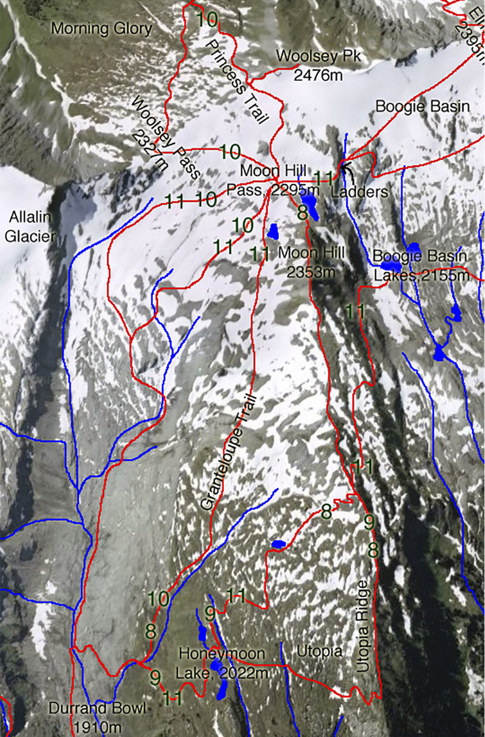
Camelot – Durrand Bowl trail
- Level of hiking: Moderate
- Lowest elevation: 1910 m, Durrand Bowl
- Top elevation: 2353 m, Moon Hill
- Total elevation gain: 640 m
- Total distance: 8 km
Route:
From the Durrand Glacier Chalet walk in the direction south, past the private hut.
There take the trail leading west, and follow the trail diagonally down a long side-slope which is at first forested. Follow this trail to the Durrand Creek Bridge. Cross the bridge and follow the main trail leading to your right (west). After a few hundred meters you come to a second branch-off, again continue on the main trail leading to your right (west). This will bring you to Honeymoon Lake.
At the south end of the lake take the trail leading towards south (left), winding its way up to the upper Utopia Ridge. Once you are on the ridge (at the top of the shale switch backs) branch off to the left and after a few more meters of up-hill branch off to the right and walk downhill (west/southwest) into the Boogie Basin along the west slopes of Moonhill. Cross the lower part of Boogie Basin, following the markers. Link into the marked and cut trail leading up to the Camelot Ridge staying left at any branch-offs, arriving at the crest of the Camelot Ridge. Follow the trail along the scenic ridge to its most south end.
Now descend a few steps and then cross the upper Boogie Basin, along a marked trail, level towards Moon Hill Pass. This leads you past fixed chains, two ladders and fixed ropes. From the Moon Hill Pass walk along the marked trail downhill, along the left (west) side of the upper Durrand Bowl back to the Durrand Glacier Chalet.