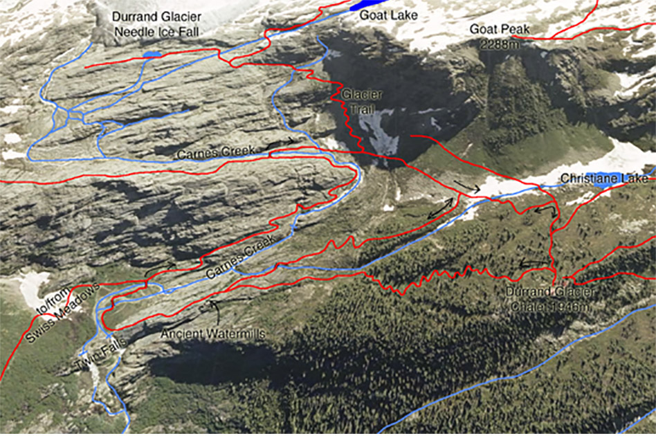
Twin Falls Loop
- Level of hiking: Easy
- Lowest elevation: 1692 m, Twin Falls
- Top elevation: 1946 m, Durrand Glacier Chalet
- Total elevation gain: 254 m
- Total distance: 2.5 km
Route:
From the Durrand Glacier Chalet walk for 30 meters towards east, past the shower building. There take the trail that branches left (north), follow the trail down the wide gully (Back Alley), to the Twin Falls. At the Twin Falls cross both bridges towards east. After the second bridge go right and follow the trail and markers up-hill (south-east), leading along Carnes Creek, as far as the upper Carnes Creek Bridge. Cross this bridge and follow the trail back to the Durrand Glacier Chalet.