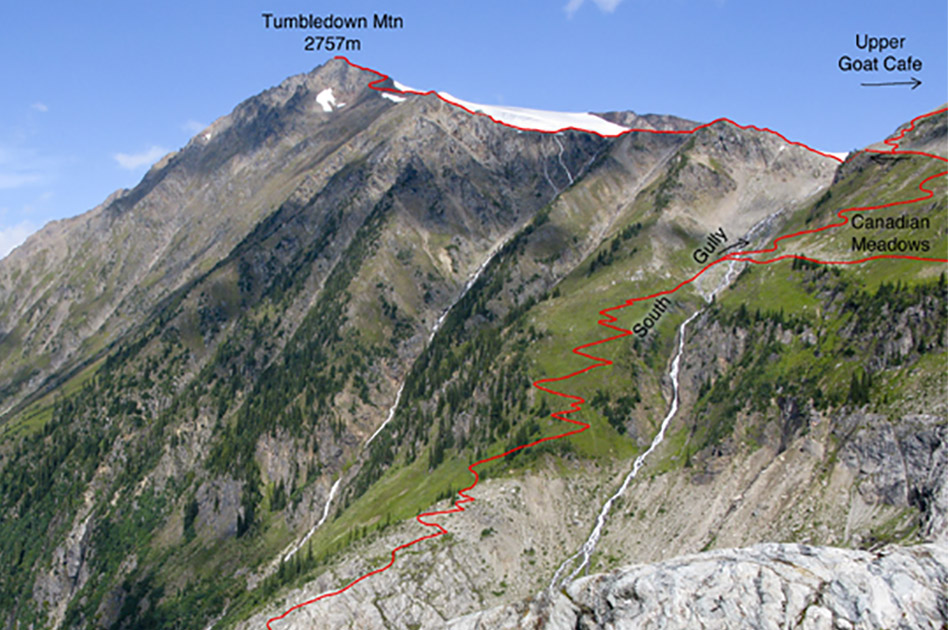
Tumbledown Mountain trail
- Level of hiking: Difficult
- Time: 7 hours
- Lowest elevation: 1850 m, upper Carnes Creek
- Top elevation: 2757 m, Tumbledown Mountain
- Total elevation gain: 1002 m
- Total distance: 9.5 km
Route:
From the Durrand Glacier Chalet follow the main trail past the shower building towards east for 150 meters, cross the tiny stream and continue east for 60 metres more and then follow the main trail branching off towards the left and downhill to a bridge. Cross the bridge and keep following the markers and wide trail to the upper Carnes Creek.
Cross the Carnes Creek Bridge and branch off to the right and walk along the marked trail up the bed-rock ridge. This brings you past four sections with fixed chains. Eventually you reach the base of the South Gully. There follow the wide trail half way up the South Gully, to where it crosses a creek. At this point take the upper trail to the upper Canadian Meadows, where you will find a large terrain bench directly below the final scree slope. Follow this terrain bench towards west (red markers), to the upper end of the Tumbledown Gully. Keep following the red markers, leading left of the glacier to the East Ridge of Tumbledown. Walk and scramble along this ridge (red markers) to the summit of Tumbledown. Do not walk on the snow-covered glacier, hidden dangerous crevasses!!! Descend the same route back to the Durrand Glacier Chalet.